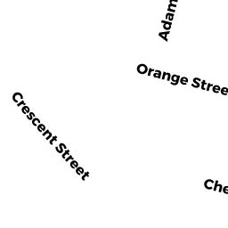
153 -55 ADAMS ST
Owner Information
SHAIKH, JAVED I. & AMRIN J.
11 RANDALL ST.
WALTHAM, MA 02453


Property Details
153 -55 ADAMS ST is classified as a Apartments with Four to Eight Units (Multi 4-8).
The primary structure on this property was built in 1900. There are 3,507ft2 of built area within this property. There is 3,507ft2 of residential/living space within this property. This property is listed as having 16 rooms. There are 4 units within this property.
153 -55 ADAMS ST is valued at $918,700. The land is valued at $320,000 and the structures are valued at $598,700.
The most recent deed for 153 -55 ADAMS ST is recorded at the local registrar in Book 59666, Page 223. 153 -55 ADAMS ST was last sold on Wednesday, August 1, 2012 for $565,000.
Assessment data from fiscal year 2022.
Flood Data
According to the FEMA National Flood Hazard Layer, this property does not appear to be in a flood zone. It may also be in an area not yet reviewed. Nonetheless, confirm this information prior to taking any action.
To view the flood hazards around this property, create a FEMA "Firmette" Map of the area around 153 -55 ADAMS ST.
Broadband Internet Providers
| Provider | Type | Bandwidth (mbps) | |
|---|---|---|---|
| RCN | Cable | 1000 | 20 |
| GCI Communication Corp. | Satellite | 0 | 0 |
| HughesNet | Satellite | 25 | 3 |
| VSAT Systems, LLC. | Satellite | 2 | 1 |
| Comcast | Cable | 1000 | 35 |
| Verizon New England Inc. | Fiber | 940 | 880 |
| Verizon New England Inc. | DSL | 15 | 1 |
| Viasat Inc | Satellite | 100 | 3 |
| Crown Castle Fiber | Fiber | 0 | 0 |
| RCN | Cable | 500 | 20 |
Broadband service provider data from December 2020.